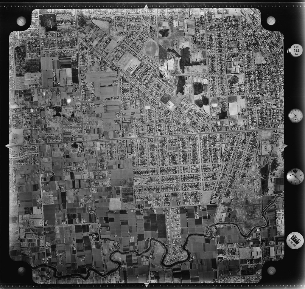
Aerial photo of area – 1949. City of Charles Sturt, reproduced with permission.
Window Version: 17
WindowIdentifier: 17
XAxisResolution: 2032.00 ( 12.5 microns )
YAxisResolution: 2032.00 ( 12.5 microns )
WindowWidth: 18939
WindowLength: 20018
XAxisUpperLeft: 0
YAxisUpperLeft: 9857
BasePixelSize: 0.00000
Enlargment: 100.00
Subscans: 8
SubScanOffsets: 1118 3358 5598 7838 10078 12318 14558
NrofLines: 16014
NrofBytes: 30302
NrofPixels: 15151
LinesSent: 16014
FirstLine: 0
LineOrder: 1
NrOutputBits: 8
ImageComposition: 0x0002 ( IC_MultiLevelBW )
ColorChannelNr: 0
ProcessorType: 0 ( Little Endian )
ScanMode: 0x004C ( SM_MATCHING:SM_CROSSFADE:SM_FILLHOLES )
ImageType: 0x00021A01 ( IT_DURCHLICHT:IT_FINALSCAN:IT_HOMEPOS:IT_SERVERSCAN:IT_MAPPING )
BlackPoint: 9 10 8 0
WhitePoint: 163 163 143 255
MinValue: 10 10 10 0
MaxVa