Following the previous blog about the changes in the landscape, this one focuses on maps and historical aerial photos which provide a visual history of the area where the market gardens were located north of the River Torrens until the early 1980s.
In 2007 I saw the first map of the Veneto market garden area in Kidman Park and Flinders Park where the Veneto families farmed. I went to Bolivar to meet Johnny and Eleonora Marchioro on their market garden. Johnny drew a map to indicate where his father and mother, Vittorio and Angelina, had their market garden on Frogmore Road until 1948 when the family moved across the river to White Avenue Lockleys and established their market garden there.
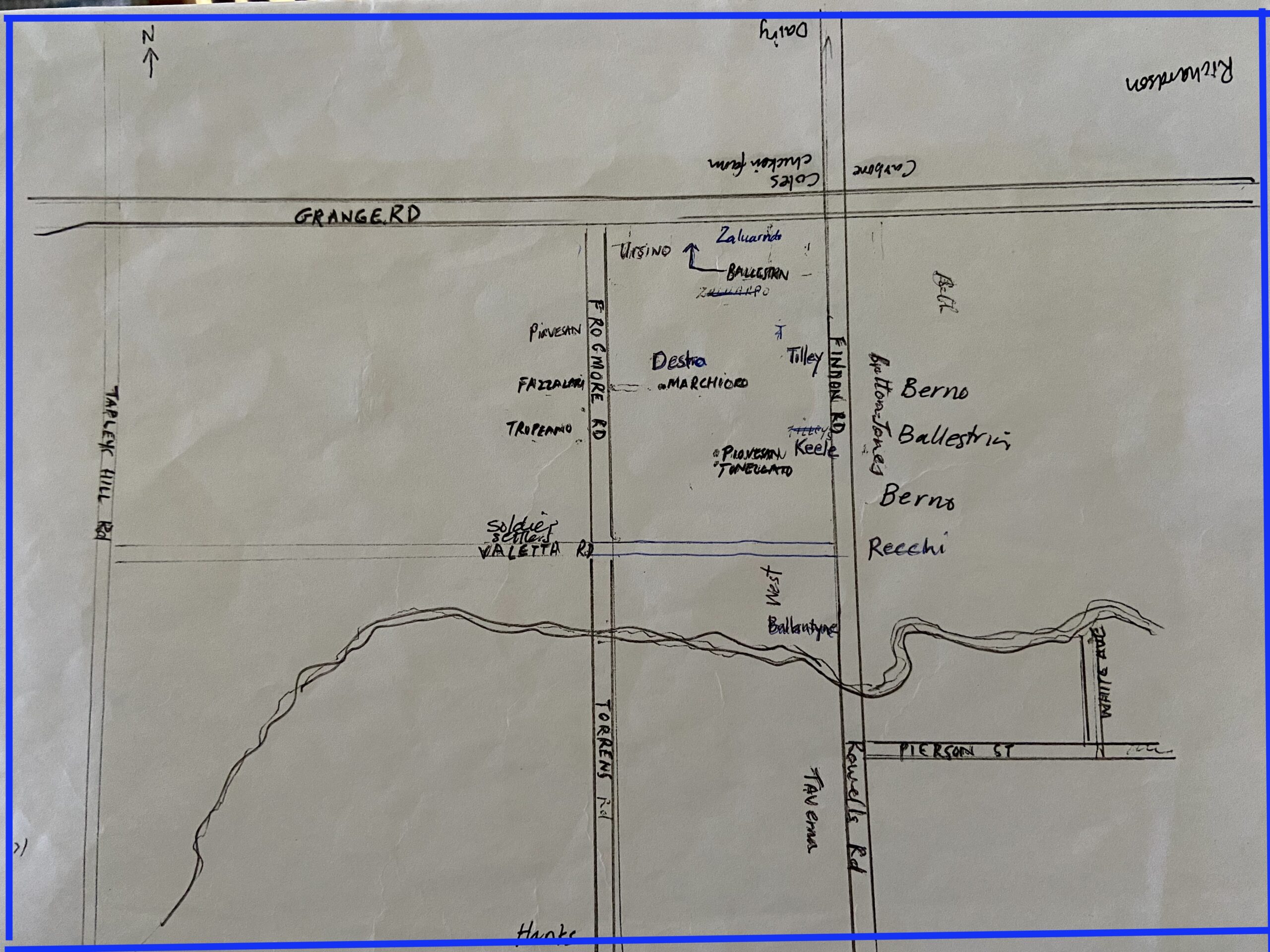
Johnny’s mud map showed the locations of the market gardens worked by other Veneto families on Frogmore Road when he was growing up. He pointed out the Piovesan’s, Tonellato’s, Santin’s, and Antonio and Romilda Ballestrin and the Zalunardo’s on Grange Road. The Berno families were on Valetta Road and Narciso and Maria Ballestrin were on the corner of Valetta Road and Findon Road before Nico and Delia Zampin lived there. Other Ballestrin families worked farms near Findon Road in Flinders Park. There were other families farming in the area and Johnny marked them on the map; Johnny identified other Italians and Anglo Australian families who were market gardeners inn the area and marked on the map, Fazzalari’s, Ursini’s, and on Valetta Road, Ballantyne’s and West’s.
All this was new information for me because I did not know much about this history of the market gardens in the western suburbs of Adelaide and the families who had migrated from the Veneto region. Other Italians like the Recchi, the De Pasquale and Mercurio families had market gardens, and there was also a long history of Chinese men who had vegetable gardens in the area.
The importance of the River Torrens
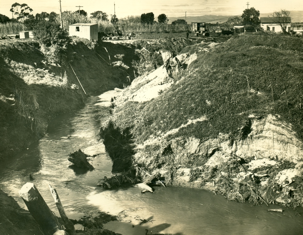
One of the significant features of all the photos is the River Torrens shown at the bottom. While it was an important source of water, early market gardeners were affected by repeated floods which ruined crops. Ironically, flooding in previous times produced the deposits of rich alluvial soil which the area so productive for growers. Rae Ballantyne’s family owned about seven and a half acres on Findon Road just near the bridge. He had been allocated the land in 1923 after serving in the Army during World War I. Rae spoke about the challenges of living near the River Torrens:
Dad told me that the first year when he moved in, he got flooded out seven times that year … The river was very narrow and full of trees and shrubs I think that is why it got flooded all the time because it just got blocked up with rubbish …
(Rae Ballantyne, OH 872/21, 25 August 2012, 8).
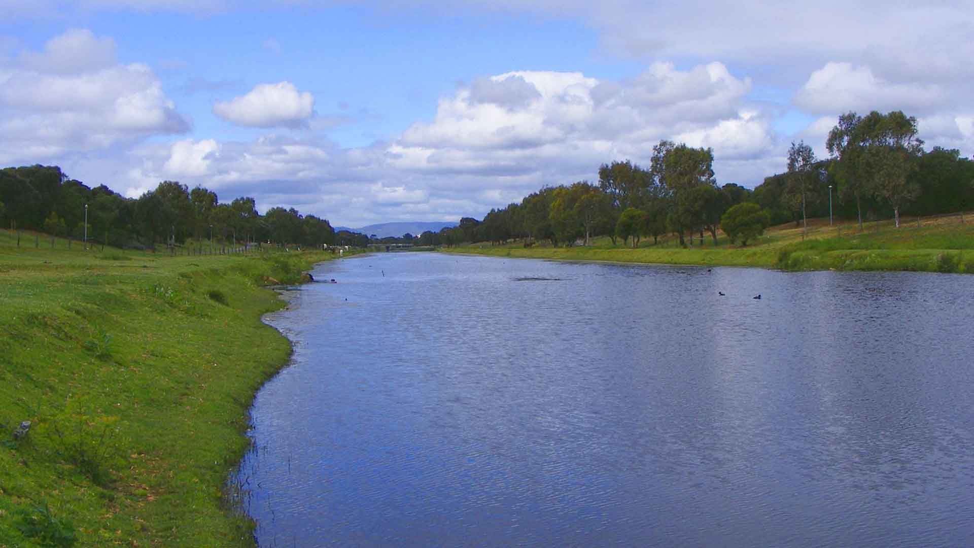
In the late 1930s, the Government diverted the course of the river, widened it and made a channel, ‘Breakout Creek’ to create a sea outlet.
Frankie Ballestrin remembers that his father talked about the modification of the River Torrens which they remembered:
I know that our people were saying that it was hand-built and with draglines and horses and scoops, done in those years … after that they cleaned it out, you see. When the glasshouses were on it wasn’t flooding anymore.
(Frankie Ballestrin OH 872/7, 12 December 2008, 19, 16)
The rich alluvial soil was an advantage of the River Torrens flood plain and the market gardeners grew celery close to the river because it was sandy and good loam. Further away from the river, other crops were grown and the market gardeners erected glasshouses so they could grow tomato crops and beans as well crops that needed open land like potatoes and cauliflowers or bunched vegetables such as onions and carrots.
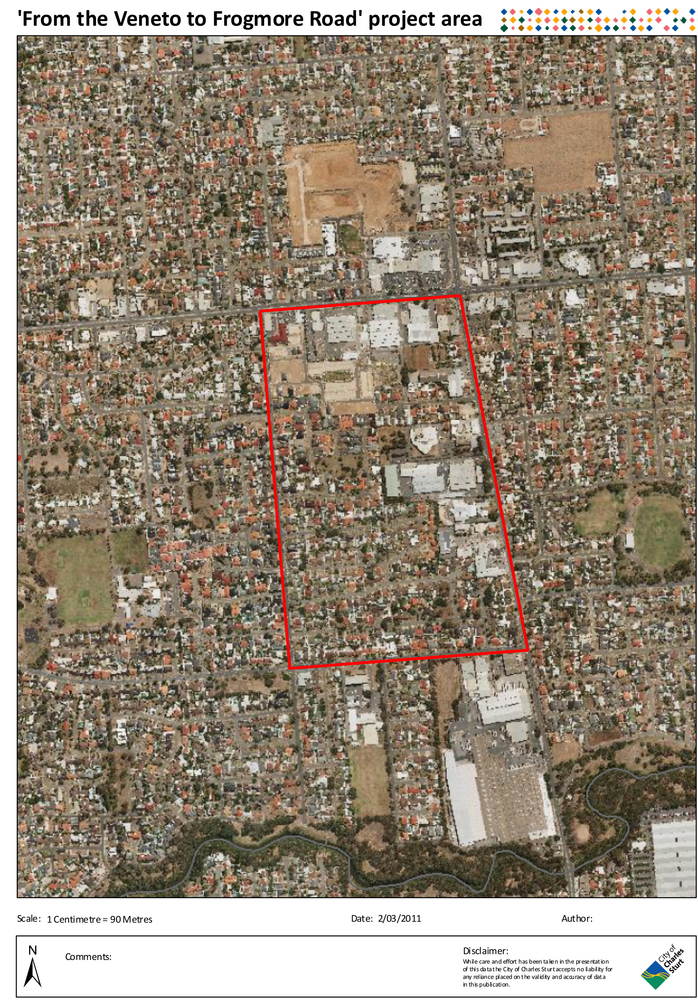
Aerial photos
The City of Charles Sturt provided some aerial photos of the area that give a clear picture of the way that land was used through the decades.
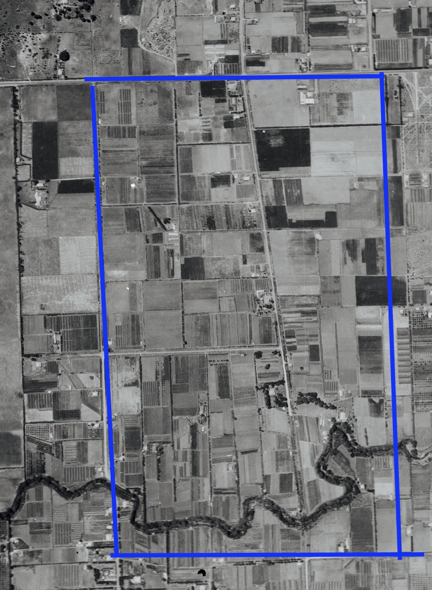
Early photos showed the large area in the now Kidman Park and Flinders Park suburbs used as market gardens and broad acre crops. It is striking to see the few houses dotted around the area amid the flat cultivated land. In the 1930s the area was a mix of landholdings of crops, dairy farms and market gardens of varying sizes and some orchards. The first aerial view was taken in 1935, a time when most of the Veneto families had leased land and were establishing their market gardens in the difficult years of the Depression.
Later photos showed the changes in the area.
For example, a photo taken in 1979 shows that land used as market gardens has decreased in favour of housing developments. And the photo taken in 2011 is a contrast again. The area is a densely populated inner suburb of Adelaide with some green areas and commercial locations.


At events for the Veneto market gardener families and friends, people have always been interested in looking at maps of the area and the location of the market gardens in the 1930s, ‘40s and ‘50s. There is nostalgia when people recall the area, the common purpose of growing vegetables for the commercial market and the sense of community particularly for the Veneto group who had made the area they called ‘Lockleys’ the place of settlement in Australia and their second home.
Madeleine Regan
12 February 2023
Thanks Madeleine
Great work and Interesting reading