From the Veneto to Frogmore and Findon Roads 1920s to 1970s
Maps
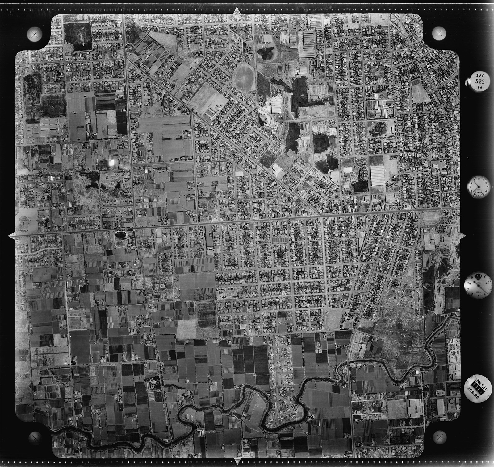
Aerial photo 1949 – Kidman Park and Flinders Park areas. Photo, City of Charles Sturt, reproduced with permission.
Aerial view of the Kidman Park, Flinders Park area, 1979.
Photo, City of Charles Sturt, reproduced with permission.
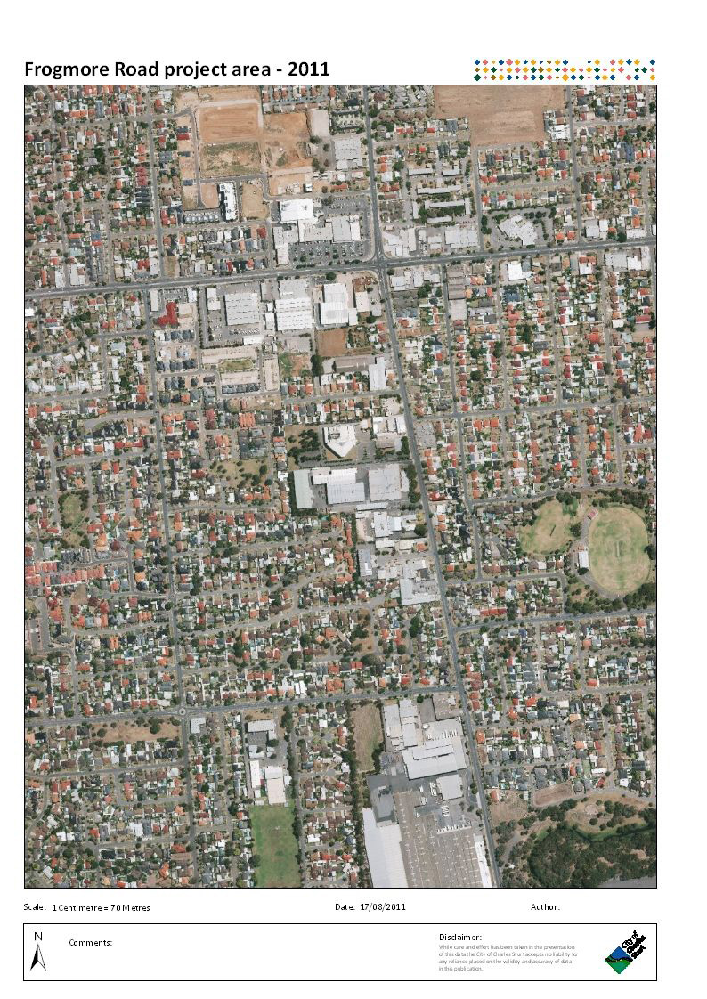
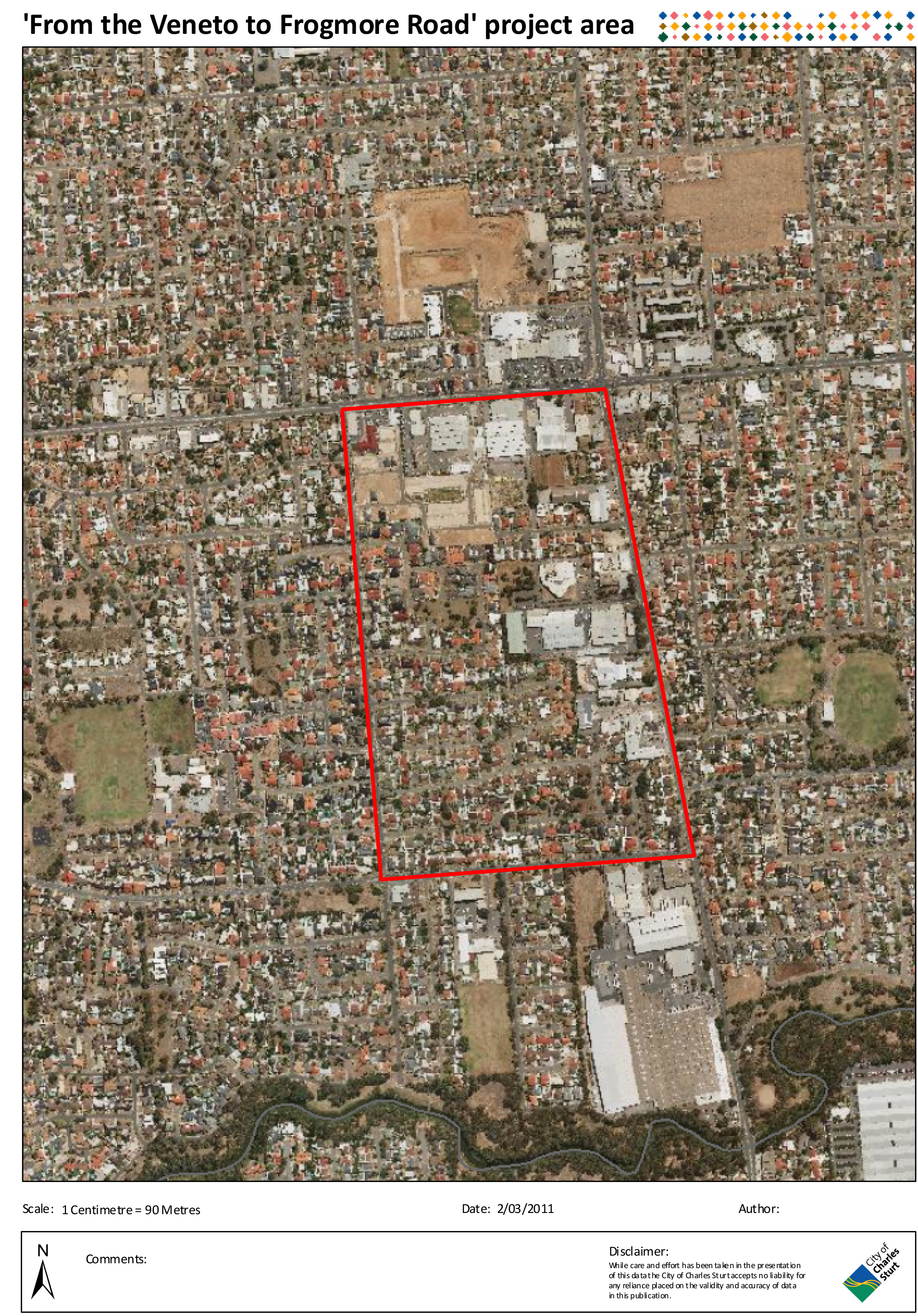
2011 CCS project area 2011 aerial
Frogmore Road, Kidman Park – Findon Road, Flinders Park area, 2011.
Map, City of Charles Sturt, reproduced with permission.
Map of the western and south-western suburbs of Adelaide, c 1930s. Map, City of Charles Sturt, reproduced with permission.
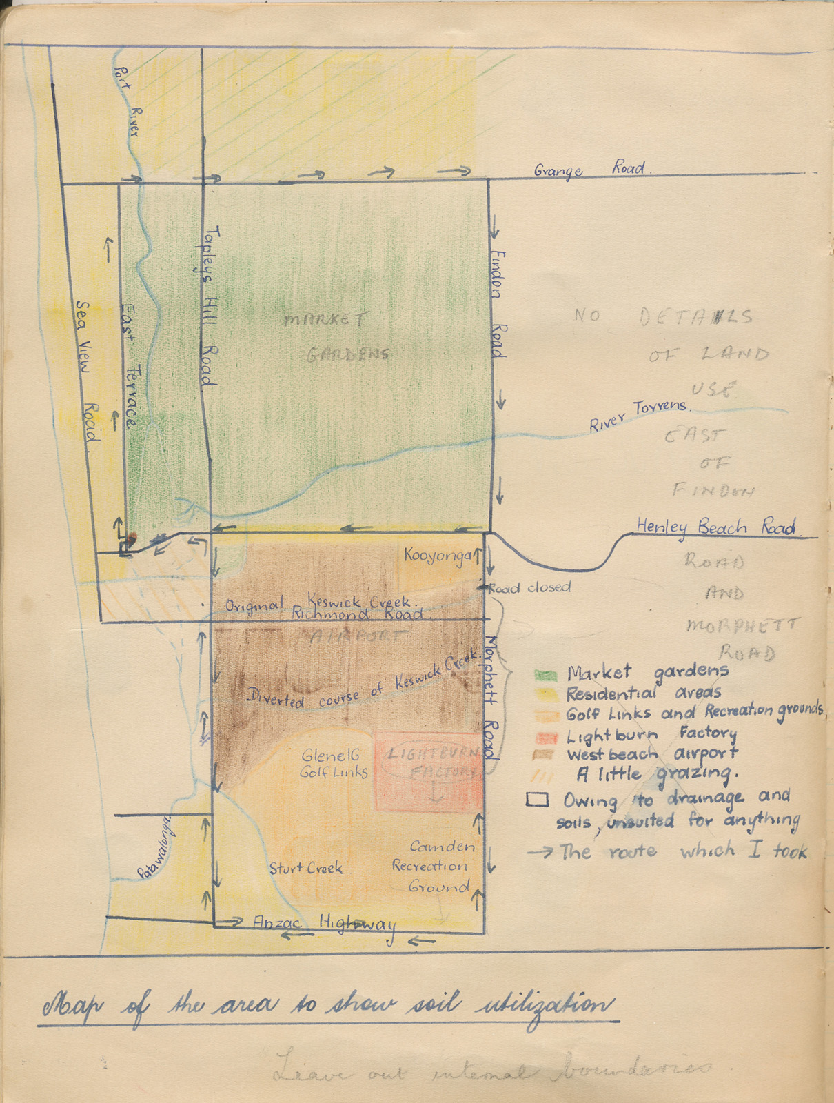
Map of soil utilization, Adelaide western suburbs
from a Leaving Honours Geography project, by Margaret Bennier, courtesy Henley & Grange Historical Society
Provinces of Veneto
1949 Aerial map – Frogmore, Findon & Valetta Roads area – with names of market gardener families gathered from interviewees
Map, courtesy, City of Charles Sturt
error: Content is protected, please contact site owner for access